Collection: Sanborn Fire Insurance Maps
The Sanborn Maps are large scale street plans produced by the Sanborn Fire Insurance Company from 1882 to 1967.
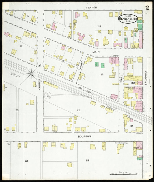
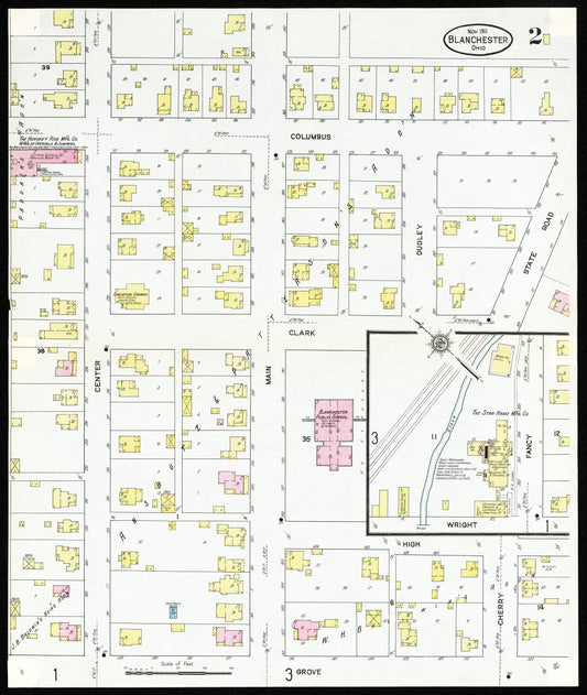
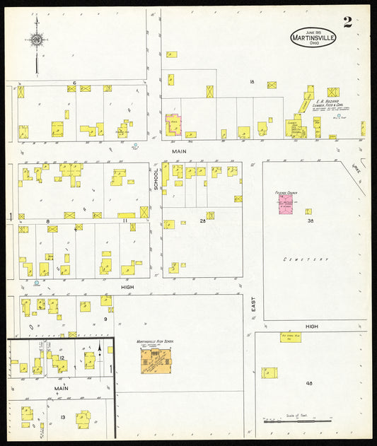
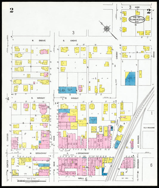
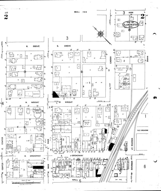
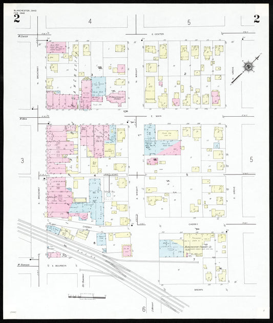
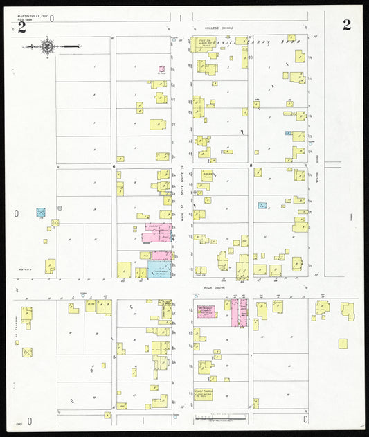
Sanborn Maps show the outline of each building including the location of windows and doors together with street names, street and sidewalk widths, property boundaries, building use, and house and block numbers.
The maps display building materials, number of floors, and building purpose (if available). Businesses, churches, and government structures are often identified as well as the business type (cotton mill, automobile repair, etc.). An individual homeowner/ occupier is not identified.
These maps are used by a wide range of researchers including local historians to locate and identify buildings and neighborhoods, urban historians to study the growth of towns and cities, and environmentalists concerned about the impact of new developments.
Source: https://oaks.kent.edu/sanborn
More information on using and interpreting Sanborn Fire Insurance Maps at the Library Of Congress.